Geography of Balochistan
Balochistan is located at the south-eastern edge of the Iranian plateau. It strategically bridges the Middle East and Southwest Asia to Central Asia and South Asia, and forms the closest oceanic frontage for the land-locked countries of Central Asia.
Total area of Balochistan is 347,190 km (134,051 square miles), which is approximately 44% of the total land area of Pakistan. The population density here is very low due to the mountainous terrain and scarcity of water. The southern region is known as Makran. The central region is known as Kalat.
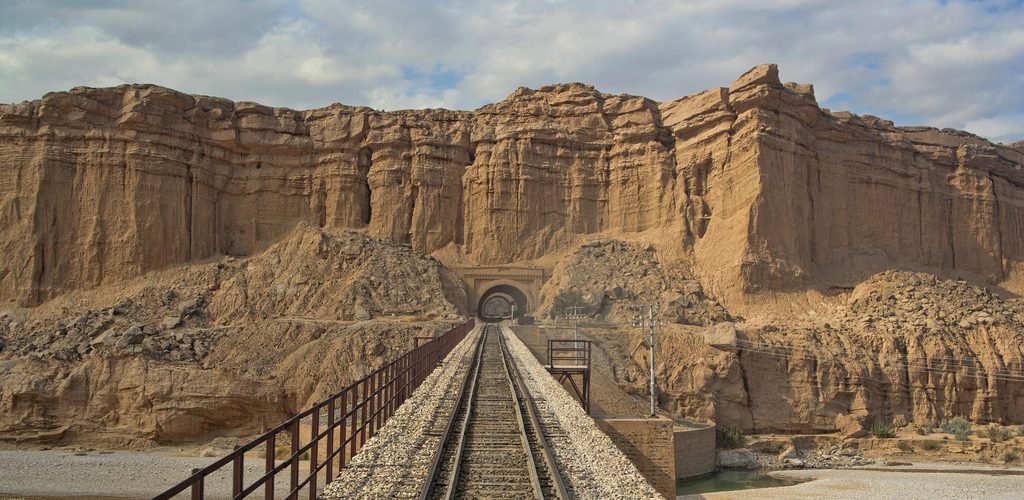
The Sulaimanki range Mountains dominate the northeast corner and the Bolan Pass is a natural route into Afghanistan towards Kandahar, used as a passageway during the British campaigns to Afghanistan. Much of the province south of the Quetta region is sparse desert terrain with pockets of towns mostly near rivers and streams.
The capital city is Quetta, located in the most densely populated district in the northeast of the province. Quetta is situated in a river valley near the border with Afghanistan, with a road to Kandahar in the northwest.
Balochistan Climate
Very cold winters and hot summers characterize the climate of the upper highlands. Winters of the lower highlands vary from extremely cold in the northern districts to mild conditions closer to the Makran coast. Summers are hot and dry, especially the arid zones of Chaghai and Kharan districts. The plain areas are also very hot in summer with temperatures rising as high as 120 ?F (50 ?C). Winters are mild on the plains with the temperature never falling below the freezing point. The desert climate is characterised by hot and very arid conditions. Occasionally strong windstorms make these areas very inhospitable.
Getting to Balochitan (Travel)
Balochistan is connected with Iran in the web at Taftan border which is open to passenger and goods trafic. In the north west it is connected with Afghanistan by Chaman border and in the south it is connected with Karachi via RCD highway. There are also good connections to Pakhtunkhwah from Baluchistan via Zhob and to Sindh via Bolan pass.
One of the most easiest and scenic way to reach Quetta capital of Balochistan is from Sukkur via Bolan pass the terain is very scenic and spectacular.
Hotel & Facilities
Quetta being the capital of the city has a 5 stat hotel The Serena Quetta and also few other 3 star hotels like lourds hotel. In the southern most port city of Gawadar there is the Pearl Continental hotel Gwadar and other smaller hotels. Rest of Balochistan there are few guest houses and 2 PTDC Motels in Taftan & Khuzdar.
Population
Balochistan has a population of around 10 million inhabitants, which makes up approximately 5% of the Pakistani population. Overall, the Baloch and Brohi population is about 47% whilst the Pashtuns are 46% of the province’s population[citation needed]. The rest are mainly Hazaras , Sindhis and Punjabi. Balochi speaking people are concentrated in the sparsely populated north-west, west, east and south; Brohui speaking in the centre of the province, while the Pashtuns are the majority in the north.The Vaghiri in north Kalat and Mastung area speak a variant of Sindhi. Similarly the Lassi of Lasbela speak another variant of Sindhi/Seraiki named after their tribe. Quetta, the capital of the province, is largely populated with Pashtuns , with Hazara and Punjabi minorities. A large number of Balochs moved in Quetta after it became the capital of Balochistan in 1970. Near the Kalat region and other parts of the province there are significant numbers of Baloch Brahui speakers. Along the coast various Makrani Balochi speaking predominate. In addition, Afghan refugees can be found in the province including Pashtuns and Tajiks. Khuzdar now has a large number of Hazaras. Many Sindhi farmers have also moved to the more arable lands in the east. There are also a growing number of other ethnic groups consisting of Kurdish, Panjabi, Mohajir and Iranians who have made Balochistan their home in recent decades.


Add comment